The gear you pack is secondary. Your survival in the Canadian backcountry depends on a ruthless pre-trip audit of potential failure points.
- Standard GPS is dangerously unreliable in deep wilderness; true navigation requires system redundancy with map and compass.
- Summer weather is deceptive; hypothermia from cold water immersion and rapid temperature drops is a primary, year-round risk.
Recommendation: Adopt a professional risk-assessment mindset, not a tourist’s. The time to prevent a rescue is before you leave your home.
The idea of the Northern Canadian wilderness is powerful. It conjures images of pristine lakes, vast forests, and the profound silence of true isolation. For the unprepared, however, that silence can become terrifying. As a Search and Rescue volunteer in British Columbia, I’ve seen the consequences when the romantic vision collides with unforgiving environmental realities. Too many adventurers arrive armed with brand-new gear and a checklist of generic advice they found online: “tell someone your plan,” “pack the ten essentials,” “be bear aware.”
While this advice isn’t wrong, it’s merely the entry fee. It doesn’t prepare you for the compounding failures that lead to a distress call. The real work of backcountry preparation isn’t just about packing a bag; it’s a systematic process of identifying and mitigating failure points. Your brand-new GPS won’t help you when dense canopy blocks the signal and every valley looks the same. Your lightweight tent is useless when it’s shredded by a storm you didn’t see coming. Your survival depends not on the gear you carry, but on your deep understanding of how and why things go wrong in true isolation.
This guide is not a travelogue. It is a serious, safety-first briefing designed to shift your mindset from that of a tourist to that of a self-reliant expedition member. We will dissect the most common and critical failure points—from technology and weather to logistics and insurance—so you can build a plan that is resilient, redundant, and rooted in the sober reality of the Canadian North.
Summary: How to prepare for a remote wilderness trip in Northern Canada safely?
- Why does your GPS fail you in 80% of the Canadian backcountry?
- How to build a survival kit for a 3-day hike in the Yukon?
- Spot X or Garmin inReach: which device saves lives when the network is dead?
- The hypothermia risk that catches summer hikers off guard in the Rockies
- When to enter the backcountry: waiting for the spring thaw to truly finish
- How to waterproof your gear effectively for 5 days of relentless rain?
- Why does standard travel insurance exclude backcountry skiing and climbing?
- How to secure a boreal forest refuge stay during peak moose season?
Why does your GPS fail you in 80% of the Canadian backcountry?
The single most dangerous piece of modern gear is a GPS device in the hands of someone who implicitly trusts it. In the dense boreal forests or steep canyons of Northern Canada, that trust can be fatal. The primary failure point isn’t the device itself, but the environment. Dense forest canopies, narrow valleys, and high canyon walls significantly degrade or completely block satellite signals, rendering your device useless precisely when you need it most. This is not a rare occurrence; it’s an operational certainty you must plan for.
Furthermore, much of the Canadian backcountry is not a “trail” in the conventional sense. The Great Divide Trail Association, for instance, openly states that the GDT is often just a wilderness route. They report that navigation challenges are significant as the trail is officially signed only in portions. This means you might be following a line on a screen that corresponds to no visible path on the ground. In repetitive terrain where every hill and creek looks the same, a GPS without a signal becomes a dead weight, and you’re left disoriented.
The only solution is system redundancy. This means you must carry, and be an expert in using, a physical map and a compass. Your GPS is a tool of convenience for confirming your position when it works; your map and compass are your primary, non-negotiable tools for navigation when it fails. Before you go, practice taking bearings, triangulating your position, and navigating without any electronic aids. Your life depends on this analog skill, not on a battery.
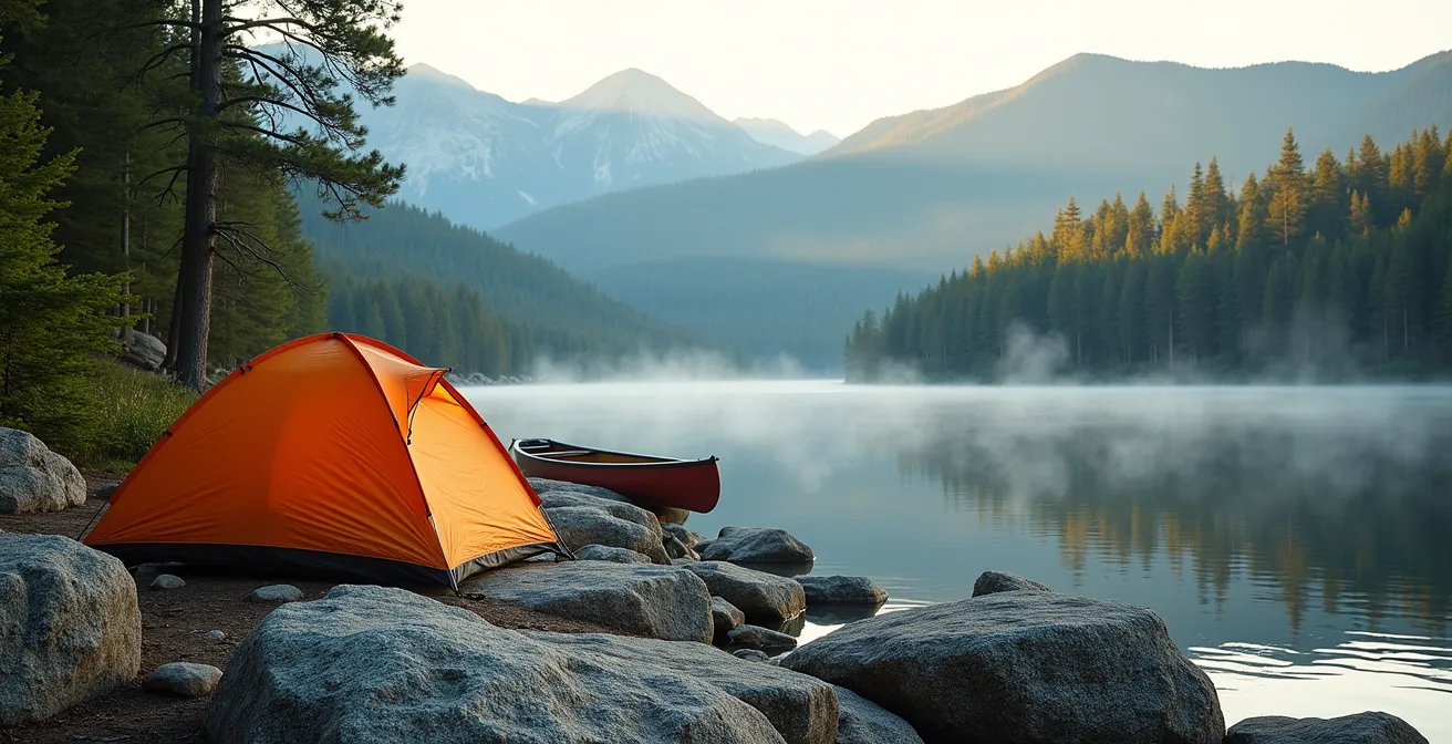
How to build a survival kit for a 3-day hike in the Yukon?
A survival kit for the Yukon is not a small pouch of trinkets; it’s an extension of your primary gear system, designed to keep you functional when a delay turns a day-hike into an overnight ordeal. The failure point here is thinking of “survival” as a separate, last-ditch event. In reality, effective survival is about using your tools early to prevent a bad situation from becoming critical. Every item must be robust, tested, and serve multiple purposes.
Beyond your tent and sleeping bag, your kit must address the key northern challenges: cold, isolation, and the need to be self-sufficient. This includes:
- Fire System: A fire-starting kit with waterproof matches, a ferro rod, and multiple sources of prepared tinder is mandatory. Fire is for warmth, signaling, and water purification.
- Shelter System: An emergency bivy or a lightweight tarp and cordage provides a critical secondary shelter if your primary tent is lost or damaged. It’s your protection from exposure.
- Water System: A durable water bottle and a reliable purification system (filter or tablets) are essential. Dehydration accelerates hypothermia and impairs judgment.
- Food & Environment: A camp stove with extra fuel is crucial, as cold weather reduces canister efficiency. You must also have a system for protecting your food from wildlife, typically rope and a bag for a bear hang.

The gear shown above highlights the quality and type of tools required. Notice the robust construction of each item. This is not the place for ultralight gear that sacrifices durability. Every piece of your kit, from your first aid supplies adapted for wilderness injuries to your navigation tools, forms a web of self-reliance. It’s a system designed to keep you safe, warm, and thinking clearly until you can get yourself out or help can arrive.
Spot X or Garmin inReach: which device saves lives when the network is dead?
When you are truly outside of cellular range, a satellite messenger is your only line of communication to the outside world. It is not a luxury; it is a critical piece of safety equipment. However, the failure point many don’t consider is that not all satellite networks are created equal. The choice between a SPOT device and a Garmin inReach can be the difference between a message getting out and sending an SOS into a void, especially in Canada’s high latitudes.
The core difference lies in their satellite infrastructure. Garmin inReach devices operate on the Iridium network, which uses a constellation of 66 cross-linked satellites to provide 100% global coverage, including the poles. SPOT devices use the Globalstar network, which has significant coverage gaps in the high Arctic and other remote regions. For a trip in Northern Canada, choosing a device with incomplete coverage is an unacceptable risk.
This table, based on data from expert reviews like those found in an in-depth analysis of personal locator beacons, breaks down the key operational differences.
| Feature | SPOT X | Garmin inReach |
|---|---|---|
| Satellite Network | Globalstar (limited Arctic coverage) | Iridium (100% global coverage) |
| Two-way messaging | Yes | Yes |
| Coverage in Northern Canada | Poor to none in high Arctic | Complete coverage including polar regions |
| SOS coordination | GEOS emergency response | GEOS/Garmin Response |
| Battery life | 240 hours in tracking mode | 90 hours in 10-min tracking |
| Monthly plans from | $11.95 USD | $14.95 USD |
While two-way messaging is a feature on both, the ability to communicate with the rescue coordination center (RCC) via an inReach to describe the nature of your emergency is invaluable. As GEOS Emergency Response confirms, their protocol is to notify the local RCC. Being able to tell them “broken ankle, patient stable” versus “unconscious, severe bleeding” allows them to dispatch the appropriate resources. In the Canadian North, the choice is clear: the complete coverage and robust two-way communication of the Iridium network make a Garmin inReach the superior tool for saving lives.
The hypothermia risk that catches summer hikers off guard in the Rockies
The calendar might say August, but in the Canadian Rockies, hypothermia is a year-round threat. The most common failure point is a fatal misunderstanding of “summer” conditions. Hikers dress for the warm temperature at the trailhead, forgetting that a 1,000-meter ascent, a sudden storm, or an accidental slip into a creek can create a lethal recipe for heat loss, even on a sunny day.
The environment is primed for it. The beautiful, turquoise rivers and lakes are glacier-fed. According to wilderness safety experts, water temperatures remain just above freezing even in August. An unexpected fall during a river crossing means instant cold shock and the start of hypothermia within minutes if you are not prepared. Cotton clothing, which loses all insulating properties when wet, becomes a death shroud in these conditions. The combination of getting wet and the ever-present mountain wind can strip body heat 25 times faster than cold air alone.
Your defence is a disciplined layering system built exclusively from synthetic or wool materials. As experienced guides will attest, this system must manage moisture from the inside and repel it from the outside.
MHO Adventures guides report that temperatures on wilderness trips can fluctuate from below freezing to over 30°C in summer, making a layered clothing system absolutely essential. They emphasize that synthetic materials with moisture transport and quick-drying characteristics are ideal for both cold and hot weather conditions in the Canadian backcountry.
– MHO Adventures, MHO Adventures
This means a base layer that wicks sweat, an insulating mid-layer (like fleece or down), and a fully waterproof and windproof hard-shell jacket and pants. This isn’t just for rain; it’s your personal micro-climate that protects you from the unpredictable and rapid temperature swings that define the mountains. Complacency about summer weather is a luxury you cannot afford.
When to enter the backcountry: waiting for the spring thaw to truly finish
Choosing your trip dates is one of the most critical safety decisions you will make. The primary failure point for spring and early summer trips is underestimating the lingering impact of winter. The “spring thaw” is not a gentle awakening; it’s a volatile and hazardous period that can last well into June or even July at higher elevations. Trails can be completely submerged by meltwater, rivers become impassable torrents, and lingering snowpack on shaded slopes can hide deep crevasses or present a serious avalanche risk.
Official sources like Ontario Parks emphasize that spring backcountry conditions require extensive preparation. Trail maps become unreliable as water levels can make a marked portage disappear overnight. Your decision to go must be based on a thorough audit of current, on-the-ground conditions, not on a calendar date or a pre-booked vacation. Before you even consider packing, you must perform a go/no-go assessment.
Your 5-Point Go/No-Go Backcountry Audit: Spring Conditions
- Water & Snow Levels: Contact provincial park offices or local guide services for real-time reports on river levels and snowpack depth. Check official sources like Avalanche Canada for late-season avalanche bulletins.
- Wildfire Status: Check the official wildfire status websites for both British Columbia and Alberta. A fire hundreds of kilometers away can cause air quality issues or lead to sudden access closures.
- Trail & Access Conditions: Verify that your intended trail and access roads are actually open. Seasonal closures for wildlife activity (like bear mating season) or flood damage are common.
- Gear Readiness: Audit your gear specifically for wet and cold. Is your shelter seam-sealed? Do you have a “double-barrier” waterproofing system for your essential gear? Is your clothing exclusively non-cotton?
- Contingency Plan: What is your plan if a river is too high to cross safely? Do you have enough extra food and fuel to wait for 24-48 hours for levels to drop? If not, the trip is a no-go.
Entering the backcountry in spring is for experienced parties only. It demands a higher level of navigational skill, a deep respect for the power of meltwater, and the discipline to turn back when conditions are not what you expected. Pushing forward because you’re on a schedule is a direct path to an emergency.
How to waterproof your gear effectively for 5 days of relentless rain?
In many parts of Canada, particularly the West Coast, rain is not an event; it’s the default state. The failure point is inadequate waterproofing—thinking a “water-resistant” backpack or a single rain cover will be enough. It won’t. After days of sustained precipitation, water finds a way into everything. A wet sleeping bag, soaked electronics, or spoiled food can transform a challenging trip into a survival situation. Effective waterproofing is not a single layer of defence; it’s a redundant, multi-layer system.
The gold standard, especially for multi-day trips in areas like BC’s West Coast Trail where sustained rainfall requires double-barrier waterproofing systems, is the “double-barrier” method. This is how you build it:
- The First Barrier (Internal): This is the most important layer. Line the inside of your main backpack with a heavy-duty, waterproof pack liner. This is essentially a giant, durable dry bag that protects the entire contents of your pack from the inside. Even if your pack becomes saturated, the contents inside the liner remain dry.
- The Second Barrier (Internal Organization): Within the pack liner, organize your gear into smaller, purpose-specific dry bags. Your sleeping bag and spare clothes go in one. Your food in another. Your electronics and first aid kit in a third. This compartmentalizes your gear and provides a second layer of waterproofing. It also means that when you open your main pack liner in the rain, your critical items are still protected.
- The Outer Shell (The Backpack): Your backpack itself and its rain cover are the *least* important layers. Think of them as a sacrificial shell designed to shed the bulk of the water. Assume they will eventually fail or “wet out.” Your safety relies on the internal barriers.
This system ensures that your life-sustaining gear—your shelter, your sleeping system, your warm clothes—remains absolutely dry, no matter the conditions outside. It’s a disciplined approach that accepts the reality of relentless rain and prepares for it methodically.
Why does standard travel insurance exclude backcountry skiing and climbing?
The moment you step off a designated trail and into the unmanaged backcountry, you enter a different risk category. The failure point here is a dangerous assumption: that your standard travel insurance or provincial health care will cover the cost of a wilderness rescue. They will not. Most policies contain specific exclusions for “high-risk” activities like backcountry skiing, mountaineering, or even remote hiking.
The financial consequences can be catastrophic. A recent analysis of Canadian rescue costs highlights helicopter evacuations exceeding $52,000 for a relatively short flight. While federal military SAR operations are provided at no charge, you have no control over who responds. If a private SAR group or a provincial park service is involved, you may be liable for the full cost of the extraction. As Garmin’s own support documentation clarifies, you can be billed for non-critical extractions.
This necessitates two things: specialized insurance and a clear understanding of what “SOS” means. 1. Specialized Rescue Insurance: You need a policy specifically designed for wilderness rescue. Providers like Garmin’s SAR insurance (which reimburses costs) or specialized first-payer plans (which handle bills directly) are built for this. It covers the astronomical cost of a helicopter or other complex rescue assets. This is not optional.
2. Understanding SOS: Activating your SOS beacon is for “grave and imminent danger” to life, limb, or eyesight. It is not a taxi service for when you are tired, lost, or uncomfortable. Misuse of the system endangers the lives of rescue personnel and can still result in a massive bill if the situation is deemed non-critical. Your responsibility is to do everything in your power to self-rescue before considering activation.
Key Takeaways
- System Redundancy Over Single Tools: Never rely on a single piece of gear, especially electronics. Always have analog backups for critical systems like navigation.
- Respect Environmental Realities: The weather and terrain are unforgiving. Your plan must be based on current conditions, not a calendar, and your gear must be prepared for the worst-case scenario.
- Mitigate Financial Risk: Standard insurance is not enough. Specialized wilderness rescue insurance is a non-negotiable part of your safety equipment.
How to secure a boreal forest refuge stay during peak moose season?
Securing a remote backcountry cabin or refuge in Canada has become as competitive as booking a five-star hotel. The failure point is underestimating the intense demand and complex logistics involved. You cannot simply decide to go next week. Booking these coveted spots, especially during prime seasons like the fall moose rut, requires a strategic plan executed months in advance.
Wilderness expert Jim Baird notes that the spike in backcountry interest has made refuge bookings incredibly competitive, often requiring coordination with float plane services from hubs like Thunder Bay or Happy Valley-Goose Bay. This is a multi-step logistical chain where every link must be secured early.
Your strategy must be proactive and organized. Follow these steps to maximize your chances:
- Know Your Windows: Reservation systems for popular networks like Ontario Parks, Parks Canada, and Quebec’s Sépaq open on a precise date and time, often 5 months in advance. Set calendar alerts.
- Pre-Create Accounts: Have your accounts and payment information set up on all relevant reservation websites long before the booking window opens. The most popular spots are gone in minutes.
- Have Backups Ready: Research multiple dates and multiple locations. When your first choice is gone, you need to be able to pivot to your second or third option immediately.
- Look Beyond the Famous Parks: Investigate alternatives like Quebec’s ZECs (Zones d’Exploitation Contrôlée), which offer incredible wilderness experiences with less competition than national parks.
- Coordinate Logistics Early: Many remote refuges require a flight on a bush plane. Contact charter services *before* securing your cabin to understand their availability and booking requirements.
Finally, planning a trip during peak moose season (late September/early October) requires extra safety planning. The rut makes bulls more aggressive and unpredictable. Understand their behavior and plan your routes to give them a wide berth. Securing the refuge is only the first step; arriving, staying, and returning safely is the mission.
Your preparation for a remote Canadian wilderness trip must be as serious and unforgiving as the environment itself. Begin your planning not by buying more gear, but by methodically identifying and mitigating every potential failure point in your plan, your skills, and your mindset. This disciplined process is what will truly keep you safe.